
The Voting Rights Act Still Exists. The Supreme Court Just Made It Harder to Enforce
Kentucky’s maps did not change this week. But one of the legal guardrails voters rely on when political lines dilute representation just got weaker.
A voter in Louisville does not need to know the details of a Louisiana congressional map to feel the weight of this week’s Supreme Court ruling.
The Court did not redraw Kentucky’s districts. It did not move a precinct. It did not change who represents Jefferson County, Lexington, Bowling Green, Paducah, or Pikeville.
But it changed the legal protection voters can rely on when political lines are drawn.
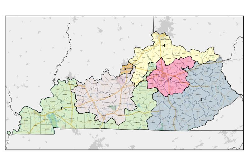
That matters here because Kentucky’s congressional and legislative maps are drawn by the General Assembly. The governor can veto them, but lawmakers can override that veto. Kentucky’s congressional and state legislative lines are drawn by the legislature as regular legislation, subject to gubernatorial veto, according to All About Redistricting.
The Kentucky Legislative Research Commission says the General Assembly is responsible for periodically redrawing the boundaries of Kentucky’s congressional and state legislative districts.
So when the Supreme Court narrows one of the main federal tools used to challenge discriminatory maps, the practical result is clear.
More power shifts back to the people who draw the lines.
In Kentucky, that means Frankfort.
A Louisiana map became a national voting-rights test
The case is Louisiana v. Callais.
After the 2020 census, Louisiana drew a congressional map with one majority-Black district out of six. Black residents make up roughly one-third of Louisiana’s population. A federal court found that the map likely violated Section 2 of the Voting Rights Act. Louisiana then drew a new map with two majority-Black districts.
That second map was challenged as an unconstitutional racial gerrymander.
On April 29, 2026, the Supreme Court ruled 6-3 against the Louisiana map. Reuters reported that the decision weakened the Voting Rights Act by restricting the ability of minority groups to challenge electoral maps under Section 2.
Section 2 bars voting practices that deny or dilute voting power based on race. For decades, it has been one of the tools voters could use when district lines weakened minority communities.
The Court did not only decide a Louisiana map dispute.
It changed how hard it will be to prove that a map violates Section 2.
That is the larger story.
One of the last federal guardrails just got narrower
The Voting Rights Act used to have stronger federal protections before states and localities changed voting rules.
In 2013, the Supreme Court weakened another major part of the law in Shelby County v. Holder, which ended the preclearance system that required certain states and localities with histories of discrimination to get federal approval before changing voting rules.
Section 2 remained one of the major tools left after Shelby County.
It was never easy protection. It did not stop every bad map. It did not make every redistricting fight simple. Voters still had to sue, prove their case, and survive years of litigation.
But Section 2 gave communities a path to challenge maps that diluted their voting power.
That path is now narrower.
Justice Elena Kagan warned in dissent that the ruling rendered Section 2 “almost a dead letter,” according to Reuters.
That phrase gets to the danger.
A right can remain on paper while becoming almost impossible to enforce.
In Kentucky, the line-drawing power sits in Frankfort
Kentucky is not Louisiana.
This ruling does not prove that Kentucky’s maps violate Section 2. It does not mean a Kentucky district must be redrawn. It does not mean a court has found racial vote dilution here.
The Kentucky story is more basic.
Our risk comes from where mapmaking power already sits.
The General Assembly draws Kentucky’s congressional and state legislative districts. The governor can veto those maps. The legislature can override the veto. All About Redistricting says Kentucky’s congressional and state legislative lines are both drawn by the state legislature as regular statutes, subject to gubernatorial veto.
The Legislative Research Commission says lawmakers use Maptitude for Redistricting and data from the U.S. Census Bureau.
That means Kentucky voters depend on several layers of protection: public scrutiny, state constitutional limits, political pressure, litigation, and federal voting-rights law.
When one federal protection is weakened, the others have to carry more weight.
That is the Kentucky relevance.
Louisville shows what district lines can do
The clearest place to understand this in Kentucky is Louisville.
Louisville/Jefferson County is one of the most racially diverse parts of the state. Census QuickFacts lists Louisville/Jefferson County metro government balance as 22.4 percent Black alone and 11.0 percent Hispanic or Latino.
Those numbers do not answer every legal question. Voting Rights Act cases require detailed analysis of geography, citizen voting-age population, voting patterns, and whether minority voters can elect candidates of choice.
But the numbers show why district lines matter.
District lines can keep communities together or split them apart. They can strengthen representation, or weaken it for years.
And once maps are drawn, they often shape political power for a decade.
This ruling impacts Kentucky because Frankfort draws the lines, and weaker federal protections leave voters with fewer ways to challenge them.
The real test is whether Kentuckians pay attention before the next map is already law.
The problem is power with fewer checks
Redistricting is always political.
The harder question is what happens when politics and race overlap.
Lawmakers can say they acted for partisan reasons, not racial reasons. But in many places, race and party are closely connected in voting patterns. That makes it easier to hide racial harm behind partisan intent.
This is where the ruling becomes dangerous beyond Louisiana.
If voters have fewer tools to challenge racial vote dilution, mapmakers have more room to protect their own power. The people who benefit from the lines gain more freedom to draw them. The people harmed by the lines face a harder path in court.
That is democracy erosion in plain terms.
It does not happen only through canceled elections.
It can happen through districts that predetermine whose votes count less.
What Kentuckians can do before the next map is drawn
There is no single Kentucky official who can undo a Supreme Court decision.
But that does not mean Kentuckians are powerless.
That leaves Kentuckians with a clear task: hold state lawmakers accountable before the next maps are drawn.
Kentuckians can:
Follow fair maps work in Kentucky. Start with the League of Women Voters of Kentucky’s redistricting and Fair Maps work.
Ask state lawmakers where they stand. The key question is simple: Will they support a transparent, public, community-centered redistricting process before the next maps are drawn?
Watch county splits and community splits. When maps are proposed, look for whether cities, counties, neighborhoods, and communities of interest are kept together or divided.
Use public data. State election records, Census data, and district maps help voters see how power is arranged.
Support voting-rights litigation and civic groups. Groups such as the League of Women Voters, ACLU, NAACP Legal Defense Fund, and local civil-rights organizations will be central to monitoring what comes next.
Document local impact. If a community’s political voice is weakened by district lines, that story needs records, maps, turnout data, public testimony, and local witnesses.
The Supreme Court ruling makes the legal path harder but it does not make public pressure meaningless. It makes public pressure more necessary.
The next redistricting fight starts before the map appears
The safest thing for people in power is for voters to treat redistricting as too technical to follow.
It is full of maps, numbers, precincts, census blocks, court tests, and legal terms. That complexity works in favor of the people who already hold power.
But the basic issue is not complicated.
District lines decide whose votes can build power.
This week, the Supreme Court made it harder to challenge maps that dilute minority voting strength. Kentucky’s maps are still drawn in Frankfort. The next redistricting fight may not come tomorrow.
By the next time Kentucky draws its maps, voters may have fewer tools to challenge lines that weaken minority representation.
And when the rules change, voters need to know before the next map is already law.
Direct source section with specific URLs
U.S. Supreme Court, Louisiana v. Callais opinion
Primary source for the April 29, 2026 ruling.
https://www.supremecourt.gov/opinions/25pdf/24-109_21o3.pdf
Supreme Court docket, Louisiana v. Callais, No. 24-109
Useful for the judgment date, vote alignment, and case status.
https://www.supremecourt.gov/search.aspx?filename=%2Fdocket%2Fdocketfiles%2Fhtml%2Fpublic%2F24-109.html
Reuters, “US Supreme Court guts key provision of Voting Rights Act”
Current news coverage of the ruling and its national implications.
https://www.reuters.com/world/us-supreme-court-blocks-louisiana-voting-map-with-second-black-majority-district-2026-04-29/
Associated Press, “The Latest: Supreme Court weakens a key tool of the Voting Rights Act”
Current national coverage and reaction.
https://apnews.com/article/1e22a59251c472dc7a6b72164a526c27
The Guardian, coverage of Louisiana v. Callais
Useful for civil-rights reaction and dissent framing.
https://www.theguardian.com/us-news/2026/apr/29/supreme-court-louisiana-congressional-map-case-ruling
All About Redistricting, Kentucky
Explains that Kentucky congressional and state legislative lines are drawn by the legislature, subject to gubernatorial veto.
https://redistricting.lls.edu/state/kentucky/
Kentucky Legislative Research Commission, Redistricting Information
Official Kentucky source on who redraws district boundaries and what data/software legislators use.
https://legislature.ky.gov/Public%20Services/GIS/Pages/Redistricting-Information.aspx
Kentucky State Board of Elections, Registration Statistics
Voter registration statistics by district, county, and precinct.
https://elect.ky.gov/Resources/Pages/Registration-Statistics.aspx
League of Women Voters of Kentucky, Redistricting
Kentucky fair maps and redistricting reform resource.
https://www.lwvky.org/redistricting
U.S. Census Bureau QuickFacts, Louisville/Jefferson County metro government balance
Demographic source for Louisville/Jefferson County.
https://www.census.gov/quickfacts/fact/table/louisvillejeffersoncountymetrogovernmentbalancekentucky/PST045225
U.S. Census Bureau, Citizen Voting Age Population Special Tabulation
Data source used in voting-rights analysis.
https://www.census.gov/programs-surveys/decennial-census/about/voting-rights/cvap.html